


News

LocationMind, a geospatial technology venture originating from the University of Tokyo, is introducing its two flagship products, Data Citadel and Kizuna Flow, at FOSS4G in Hiroshima. These products bridge the gap between complex GPS/mobility tracking and actionable intelligence, empowering global planners, data engineers, and policymakers to build resilient, safe, and sustainable cities.

Data Citadel - From complex mobility data to processed value-added Geospatial dataset ready for decision-making
The Data Citadel is LocationMind’s enterprise geospatial data provisioning and analytics platform, designed as a unified architecture that bridges the gap between complex data and actionable intelligence. The platform acts as a secure command spine, streamlining cross-team collaboration by directly bridging client requirements to technical execution.
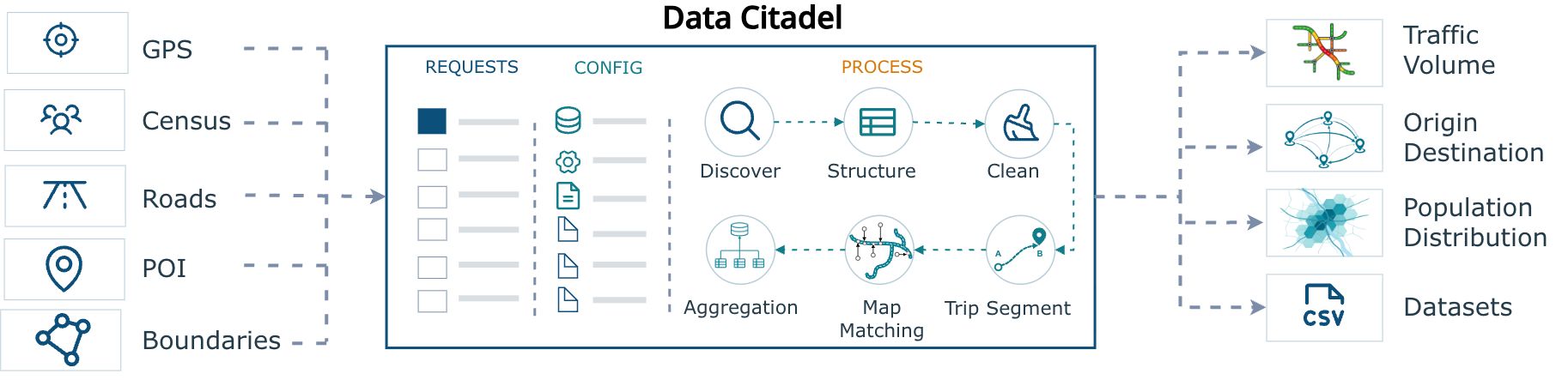
It delivers substantial enterprise value by establishing strict, auditable data governance and compliance through Auth0-powered Single Sign-On and granular role-based access control. By centralizing Pipeline Orchestration, the platform acts as an active trigger point for automated data processing, instantly provisioning direct storage locations upon request approval. This powerful pipeline is monitored through a centralized dashboard with enterprise-wide error logging and integrates with an interactive Data Statistics Engine to calculate complex statistical distributions with linear/logarithmic toggles and one-click exports.
Learn More: https://locationmind.com/products/datacitadel-e/
Kizuna Flow - understanding unseen bonds that connect humanity
Kizuna Flow is LocationMind’s geospatial analysis and visualization platform. The platform features a unique "two-story" application architecture built around core features and modular plugins:
- Kizuna Core / Application Engine:
This core layer handles lean, maintainable dashboard functions, including Stay Population, Origin-Destination (OD) mapping, Traffic Volume, and Point of Interest (POI) footfall. - Kizuna Plugin / Business Logic:
This layer defines specific Key Performance Indicators (KPIs) tailored to individual projects and links this project-specific data to the user interface.
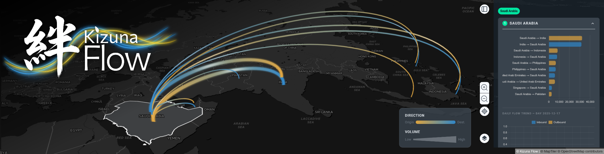
It delivers unique value by utilizing a modular, plugin-based system design that eliminates development redundancy across projects by unifying common assets, maps, and libraries into a lean core engine. It seamlessly integrates commercial mobility datasets, including mobile GPS and Call Detail Records (CDR), with open-source geographic information to power high-resolution visualizations of critical human mobility metrics, which addresses a wide range of use cases.
Learn More: https://locationmind.com/products/kizunaflow-e/
FOSS4G Hiroshima 2026 Official Website : https://2026.foss4g.org/en/